Potential
|
POTENTIAL |
|||||||||
 |
Coordinator: Pieter Janssens |
||||||||
|
Projects Partner and Institution: |
|||||||||
| Key words: | |||||||||
|
Abstract: The objective of the POTENTIAL project was to increase nitrogen (N) and water use efficiency in potato by co-scheduling of N fertilization and irrigation water. Special attention was paid to the spatiotemporal variation in water and N deficit in potato fields. To meet this objective, innovative sensing solutions were used such as drones, satellites and geophysical soil scanners. During the POTENTIAL project, between 2017 and 2019, 11 experimental fields were set up in Belgium, 3 in the Netherlands and 3 in Denmark. In the experiments, two different setups were used. On a part of the experimental fields a variation in water and N status was induced by applying varying doses of irrigation and fertilization. In another part, the variation in the field was studied, without adding extra degrees of variation in water or nutrient input. In each field in situ data were collected. At the beginning of the growing season soil properties were determined. Soil sampling was conducted every three to four weeks to measure soil water and nitrate content over the growing season. Alongside with the soil observations, plant measurements such as stomatal conductance were measured to provide indications on plant water stress. Harvest quantity and quality was determined at the end of each growing season by taking yield samples. Regular drone flights were executed during the growing season. Drones were equipped with multispectral and thermal cameras. In addition, Sentinel-2 multispectral satellite imagery was used to study the co-scheduling of irrigation and N-fertilization in potato. From the drone and the satellite images, various spectral indices related to canopy were derived such as Normalized Difference Vegetation Index (NDVI), Red-edge NDVI (ReNDVI), Chlorophyll Index - green (CIgr) and red edge (CIre). The thermal camera permitted to derive surface temperature maps and to calculate thermal i the crop water stress index (CWSI). The spectral indices correlated well with stomatal conductance at high vegetation cover in Belgium and Denmark, as well as with potato tuber yield. This was the case for both drone- and satellite- derived indices and shows the possibility of using spectral indices to reveal variation in plant stress over the potato field. However, a similar correlation was found between the same spectral indices and soil N, which is linked to the variation in N status, and thus N fertilizer need. When potato suffers from water stress, it stops assimilating N, hence, water stress and deficiency of N uptake are strongly entangled. This makes it hard to distinguish between water and N shortage based only on spectral indices. Nearly all spectral indices responded similarly to water and N deficit. In Denmark it was demonstrated that, when water stress is kept to minimum, side dress N fertilization in potato can be organized according to a three-step procedure that involves construction of a N dilution curve (relation between dry matter and N concentration) for potato and its utilization to characterize potato N status during the season by calculating dry matter and N concentration from remote sensing data. Most satellite based decision support tools use the most recent images to generate task maps for variable rate irrigation and fertilization, but historical satellite images collected in dry periods, such as the summer of 2018, may also contain valuable information, e.g. on the occurrence of dry spots in the field. Prior to drone and satellite acquisition, a non-invasive soil scan was conducted using a rigid-boom, multicoil electro-magnetic induction device (EMI) mounted on a sled, which was dragged over the field using a quad-bike. There was no unequivocal relationship between ECa derived from EMI scan and spectral indices acquired from the drone. However, the acquired EMI data were also combined with the NDVI data in a fuzzy c-means cluster algorithm to delineate management zones. These maps provide detailed insights into the soil that a classical soil map is not able to deliver. |
|||||||||
|
Project structure: In the first year field trials in farmers’ fields in Belgium, The Netherlands, and Denmark are set up by Soil Service of Belgium, Wageningen University & Research, and Aarhus University respectively. A range of state-of-the art and beyond sensors will be applied to characterize spatio-temporal variations in soil and crop at different potato farms. The sensors will be satellite, drone and tractor-borne including spectral systems as on the Sentinel satellite and combined as in the double reflectance-laser gap fraction analysis sensor developed by AU for determination of N uptake in crops. Soil moisture and soil nitrate content is collected in situ, and compared with ECa maps obtained with multi-configuration EMI soil scanners (Forschungszentrum Jülich, Université de Liège, AU) and a tractor mounted TDR soil water content mapping system developed at AU. Output from these sensor systems will be related to in-field crop response maps to water and N stress as well as yield. Classical agronomic recommendation services for irrigation and nitrogen management in the four partnering countries will be listed and assessed. A way of practice will be outlined indicating how spatial information can be integrated into the classical agronomic recommendations for irrigation and fertilization. Special attention will be given to the investigation of spectral information to distinguish between nitrogen and water deficits and their relation to soil properties. In the second year of the project, field trials will be set up following a split design where one part of the field is fertilized and irrigated homogeneously. In the other part variable rate irrigation and N fertilization is conducted following the variable rate decision support systems (DSS) developed in year 1. Soil moisture, soil nitrogen and yield are collected in both parts of the field. Water use efficiency and nitrogen use efficiency is calculated and compared between both parts of the field. For the implementation of the variable application of water and nitrogen the consortium has the assistance of Jacob Van den Borne in the Netherlands. Jacob Van Den Borne is a potato farmer and is equipped with machinery that allows variable N fertilization, as well as a Fasterholt irrigation gun. The Danish SME Fasterholt Maskinfabrik A/S is an experienced manufacturer of raingun machines primarily for the European market. Fasterholt is currently developing a variable rate raingun with GPS positioning, with the ability to adjust for wind-deflection and to direct the gun according to pre- programmed maps of desired surface application rates. |
|||||||||
|
Implementation: During POTENTIAL, SSB, VITO, Ulg, FZJ and AU are responsible for the data collection on the field trials as described in the workplan (WP1). During the project, data sharing between partners is essential to obtain new insights in the added value of the improved precision farming. The manual, developed during the project, will include the contact persons, appointed for each parameter, for external data exchange. |
|||||||||
|
Outcome/deliverables: The following output will be provided during the POTENTIAL project, as integrated in WP 4:
|
|||||||||
|
Main outputs:
Results of the project: Data and resources |
|||||||||
|
References coordinator and leaders of each WP: |
|||||||||
|
Contact Point for Communication/Dissemination activities: Pieter Janssens |
|||||||||
|
Contact Point for Open Data/Open Access activities: Pieter Janssens |
|||||||||
|
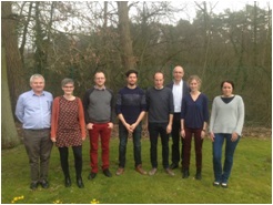
Picture of the research team: |
|||||||||

